We’ve looked at what geospatial data is and where you can find it, but what is it used for? That’s a bit of a complicated question. There are many ways it can be used, some of which are related and others which are actually built on top of one other.
For example, most use cases of geospatial data involve visualizing the data as a map. From there, a business may use their analysis to choose where to locate their stores or advertisements, and a private equity firm may use data on that to decide which companies are worth investing in. Or a government agency may use a different kind of analysis to determine where critical public buildings and infrastructure should be built.
To demonstrate further, we’ll look at 10 popular uses of geospatial data and some of the types of data that power them.
Top 10 uses of geospatial data & where to get the data you need
Geospatial data is often used in scientific or government administration contexts, but it has an increasing number of commercial uses as well. From retail to investment to insurance, here are 10 scenarios where you can make use of geospatial data.
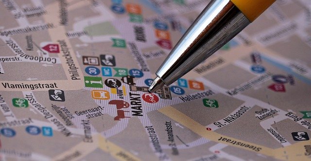
1. Mapping

One of the most common examples of geospatial data use is visualizing the area that the data describes. Whether it includes building footprints, transportation routes, or other points of interest, a precisely-drawn map based on accurate location data can be an immensely powerful tool. And not just to travelers who may not know their way around a particular area, either.
Mapping forms the foundation of many other methods of using geospatial data.
A good place to start is with SafeGraph’s Geometry Data. It uses polygons to show the locations, sizes, boundaries, and relationships between various points of interest (POIs).
2. Site Selection
If you’re a business or other organization, you want to set up shop(s) where customers and other supporters are likely to visit you. Likewise, you also want to be able to tell when things have changed around a location that make it no longer viable, and it’s time to close down and move on. Geospatial data can help you do both of these things.
There are a number of things to consider when selecting or deselecting retail sites. Where do you currently have locations? Are other nearby stores going to compete with you, or possibly help you? How close are you to where the customers you want to attract live? How accessible transportation-wise are your sites to those target customers?
Looking at geospatial data can give you answers that will hint at whether a location will succeed or fail.
A potential shortcut is using SafeGraph’s Places Data to look at the attributes of stores that are already successful (even if they aren’t your own) and try to find locations that mimic those qualities.
3. Visit Attribution

Another use case for geospatial data example is telling the difference between someone actually entering your store or just simply passing by. Comparing accurate building footprint data with precise GPS data from mobile devices lets you know how many people actually entered the grounds of your store to buy something (or at least look around).
You can also use this information to look at nearby points of interest to see if there are opportunities for sites to get greater foot traffic, or place advertising to direct more people to your store.
SafeGraph’s Geometry Data can show you accurate geofences of buildings in an area so you know the specific dimensions of business locations and exactly how much patronage your stores are getting.
4. Urban Planning

Geospatial data science techniques and applications can be helpful if you’re in government or the public sector. You can make sound community planning decisions based on data regarding where buildings are (and what they are), where people live, where they typically go in a day, and what routes they take to get there.
For instance, you can plan construction for roads or other transportation systems to cut walk/drive times to places people visit on a regular basis, such as grocery stores. Or, you can do things the other way around and plan to build important facilities, such as hospitals or schools, in areas that are already accessible and get a lot of foot traffic.
If you’re planning to use geospatial data in this context, foot traffic data can be a big help. It can give you insights into when people in your community are most active, where they come from, and where they typically go.
5. Network Planning

Telecommunications systems planning is another area in which geospatial data can be informative. For example, foot traffic data can help providers plan their infrastructure around the busiest areas in a neighborhood. This can allow them to achieve as wide a coverage as possible with the least amount of hardware. It can also inform the price they charge for setting up WiFi hotspots, with installations in higher-traffic areas being more expensive.
For other businesses, knowing how much foot traffic they get at their stores allows them to decide on the scope of the telecom plan they need. That includes where they should set up WiFi hotspots, based on how many they can afford. It also allows them to manage the bandwidth limits on their hotspots based on when they expect to be busiest.
6. Investment Research

If you work in an investment bank or private equity firm, knowing how to use geospatial data can be a powerful – yet often overlooked – tool for your portfolio. Combining location data for stores and other points of interest with foot traffic data allows you to model and predict consumer behavior and movement patterns. You can then combine this with other contextual data to get a better picture of how the businesses you’re investing in are actually performing, and which ones may be in for upturns or downturns. To start here, it helps to know as much as you can about the businesses in an area that you are planning on investing in.
7. Competitive Intelligence

Part of analyzing how well your business is doing is knowing the competition: who they are, where they are, and how their performance may be impacting your own. Geospatial data can help you figure out how much geographic influence your company has in relation to where your customers come from and where your competitors are.
For instance, you may be able to see that customers choose your store over a competitor’s because it’s more accessible in terms of parking space and transportation routes. Or you may discover that you have stores too close together in terms of walk/drive time, and that they’re competing over the same customers. Or you may notice that nearby stores you assume would be competing with you actually aren’t, because your target customers may be from different demographics and/or coming from different locations.
8. Risk Assessment

The insurance industry is another sector that is increasingly making use of geospatial data applications. To develop liability frameworks for buildings, insurers need to know a number of their geospatial traits. These include precisely where a building is, how much space it takes up, and how close it is to surrounding buildings. These attributes let them assess how vulnerable a building is to things like destructive weather, or even damage indirectly caused by other sources (e.g. a spreading fire, vehicle accident, or collapse of some sort).
Additionally, insurers need to know things like how many businesses are contained in the same building, along with what they do or sell. Some businesses present more hazards than others, which can affect risk assessment, even for nearby operations. Occupancy is another factor they have to consider. The more people who live in or visit a building on a day-to-day basis, the greater the risk for an accident to happen.
SafeGraph’s Geometry Data is a good starting point here. It offers precise and accurate information on the location and area of buildings, including buildings inside buildings (in the cases of malls, apartments, office complexes, etc.). Another ideal example of how this is useful is a McDonald’s location inside of a Walmart.
9. Trade Area Analysis

Trade area analysis is a process to which geospatial data is integral. Think of it as a big-picture version of site selection for stores. Sometimes it’s not enough to just look at how accessible a location is and how close competitors are.
Take census block groups (CBGs), for example: relative to where people live, would their general lifestyles make them want to actually buy what you’re selling? And would they be able to afford it, based on their average income range? Asking these types of questions helps you more accurately pinpoint your customer base, allowing you to adjust your site selection (among other things) to cater to the people who will most likely be patronizing your stores.
Also consider how many competitors are nearby and how well-established they are. It’s going to be tough to succeed in an area if demand for the type of product or service you sell is already being met there. This is especially true if your competitors in that area have had years to build up their reputations. You might want to consider another area where supply for your products or services hasn’t met the demand yet, and where rival businesses will be easier to compete against.
Start with SafeGraph’s Places Data to know where complementary and competitive businesses are, and how you stack up against these competitors.
10. Consumer Insights

A specific geospatial data sample may be able to give you even more granular insights into your customers’ shopping habits. For instance, you can look at other stores your patrons visit that feature specific brand names. Then you might decide to carry products of that brand, or to more heavily market them if you already carry them. You might do this by, say, making them the focus of rewards programs, or by holding seasonal sales. The goal is to meet consumers’ demands so that they don’t have to go to another business besides yours to get what they want.
Another idea is to look at businesses that consumers visit before or after they come to yours. To illustrate, imagine that you run a smoothie shop or some other type of health-conscious restaurant. You may notice that a lot of customers are going to gyms or yoga studios before or after they drop by your store. This might tell you that they’re likely coming to you to either fuel up before a workout or recharge after one. You can use this knowledge to approach these types of stores for cross-promotion opportunities, perhaps on specific days or at certain times.
Now you know some of the things that are possible when you unlock the power of geospatial data. But how exactly do you do that? We’ll show you the starting point for getting the most out of geospatial data from SafeGraph in the next chapter.