Geographic Information Systems, or GIS data, forms the backbone of modern location-based decision-making. From mapping and navigation to urban planning, retail strategy, and logistics, GIS data helps organizations understand what exists in the physical world and how locations relate to one another.
As businesses increasingly rely on location intelligence, the quality and structure of GIS data matter as much as the analysis itself. In this blog, we will explain what GIS data is, how it is used, and why SafeGraph has become one of the trusted sources for high-quality places data that supports GIS workflows at scale.
What is GIS Data?
GIS Data refers to information that is tied to specific geographic locations along with attributes that describe them. It combines geographic coordinates with information such as boundaries, categories, and identifiers, all enabling spatial visualization and analysis.
At its core, GIS data allows users to model the real world digitally and understand where something is located, what exists there, and how it relates to other places around it. Locations are represented as points, lines, and polygons, making it possible to map places, measure distance, analyze proximity and understand spatial relationships better at scale.
The combination of spatial and descriptive information is what makes GIS data so powerful. It enables organizations to move beyond static maps to analysis that supports planning, forecasting and real-world decision-making.
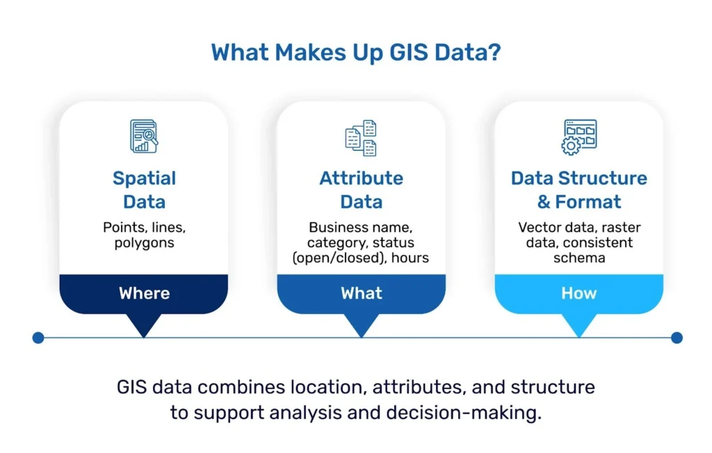
Core components of GIS Data
Most GIS datasets are built from a few foundational components.
Spatial data defines where something is located. This may appear as points, lines, or polygons that represent locations, roads, or physical boundaries.
Attribute data provides context about those spatial features. For example, a point on a map may represent a store, while the attribute data describes its brand, category, hours of operation, or opening date.
Data structure and format also matter. GIS data is typically organized as vector data, such as points or polygons, or raster data, such as gridded surfaces used for imagery or terrain. Consistent schemas and well-defined geometry are essential to ensure that data layers align correctly and can be combined without extensive preprocessing.
Together these components allow GIS systems to model the physical world in a way that supports analysis, visualization, and integration with other datasets.
How GIS Data Is Used Across Industries
Organizations use GIS data to support a wide range of applications, from mapping consumer access to services to evaluating competitive landscapes and infrastructure planning.
Retail and commercial real estate teams use GIS data to understand trade areas and site potential. Media and advertising teams rely on it to contextualize foot traffic and improve location-based planning and targeting. Governments and city planners also use GIS data to assess accessibility, zoning, and coverage of services.
One common requirement across all these use cases is reliable geographic content that accurately reflects the real world.
What Makes GIS Data Reliable for Better Decision-Making
Not all GIS data created is unique and helpful. Accuracy, freshness, and consistency determine whether location-based insights can be trusted.
Outdated records, misaligned polygons, or incomplete attributes can undermine analysis and lead to poor-quality decision-making.
Reliable GIS data requires precise geographic coordinates, clearly defined spatial boundaries, and consistent representation of places across regions. Freshness is equally important. The physical world changes constantly as businesses open, close, or rebrand, and outdated data can quickly undermine analysis.
Many organizations struggle with GIS datasets that look complete on the surface but require extensive cleaning, deduplication, or validation before they can even be trusted. When GIS data lacks accuracy or timeliness, downstream decisions from mapping outputs to strategic planning are put at risk.
This is where specialized data providers play a critical role.
How SafeGraph Supports Modern GIS Workflows
Modern GIS workflows depend on data that integrates cleanly into existing systems. Analysts and product teams need datasets that are structured, interoperable, and designed for scale.
Rather than building visualization tools or analytics platforms, SafeGraph focuses exclusively on sourcing, validating, and maintaining places data that integrates seamlessly into existing GIS environments. SafeGraph data is used by organizations working in mapping, real estate, media, retail, and others where location accuracy is non-negotiable.
The operational focus matters in practice. As Andy Stevens, Chief Data Officer, Clear Channel Europe, notes:
“We never expected the datasets to be turnkey with our existing systems and datasets from day one- there’s always a bit of work to get it to where you need it to be. We have been blown away by SafeGraph’s proactiveness in helping us work through any issues we’ve encountered.”
SafeGraph data is designed to fit directly into GIS workflows, supporting mapping, geocoding, spatial hierarchy analysis, and integration with other location-based datasets.
This approach supports GIS teams working with complex pipelines, not just idealized use cases.
What Sets SafeGraph Apart in GIS Data
SafeGraph’s differentiation comes from focus and execution.
Many data providers attempt to balance places data with platforms, visualization tools, or professional services. SafeGraph does not. Its sole focus is maintaining a trusted source of truth for physical places.
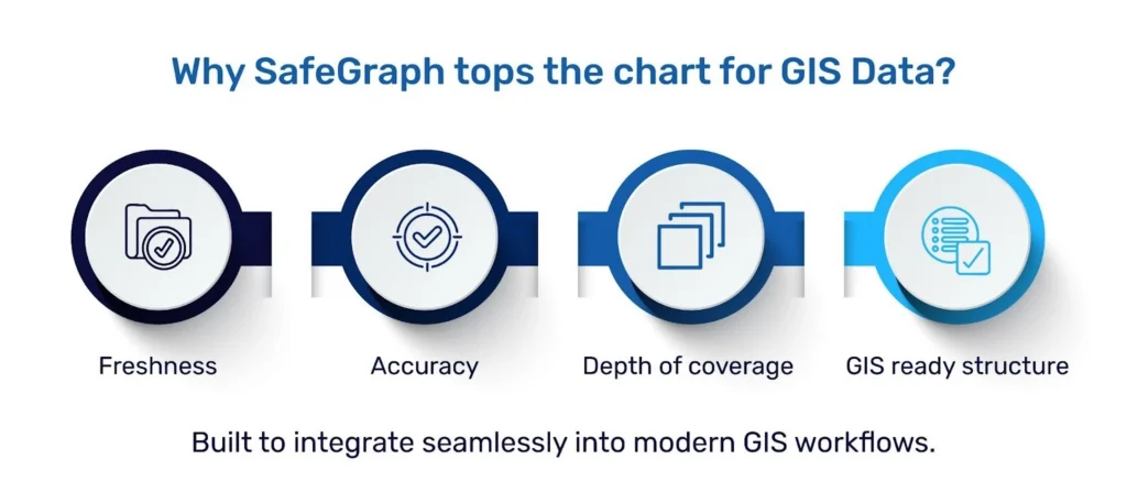
This focus enables SafeGraph to deliver:
- Monthly updates that reflect real-world changes.
- Machine-learning-cleaned and, human verified POIs
- Detailed attributes and spatial hierarchy through Placekey
- Coverage that includes non-traditional locations often missed by other datasets
This commitment to data quality is consistently recognized by customers. As Nic Babb, VP of Product at Adomni, notes:
“We pored through spreadsheets to isolate categories and look for issues in the data, and SafeGraph was the clear winner. There was just so much weird, junky stuff in the other datasets.”
By prioritizing accuracy, transparency, and consistency, SafeGraph enables GIS teams to spend less time cleaning the data and more time utilizing it to build better.
Conclusion
GIS systems are only as effective as the data they rely on. Understanding what GIS data is and how it is structured is the first step, but choosing the right data partner matters as much as choosing the right tools.
For teams building GIS workflows that depend on reliable representations of the physical world, working with high-quality places can significantly reduce operational overhead and improve confidence on decision-making.
Want to see what comprehensive, regularly refreshed POI data looks like in practice? Explore the full scope of SafeGraph Places and review the attributes available for your GIS workflows.